Crime in Marple, Pennsylvania
Updated ·Vorp Labs
The model puts major crime in Marple at 52% below the U.S. rate per resident: 87% lower for persons crimes and 44% lower for property crimes. Expected major crimes are down 7.4% from a year earlier.
- Modeled from FBI crime data for the police agencies serving Marple. Where an agency didn't report to the FBI, its totals are estimated from its past reports or similar agencies.
- The model estimates about 8.3 major crimes per 1,000 residents a year (0.4 violent, 7.9 property), against 17.2 for the U.S.
- By the model's major-crime rate per resident, Marple is lower than 51% of the 478 other Pennsylvania places and 61% of the 8,446 other places nationwide on CrimeMetric.
Where these numbers come from
The estimates start from what police agencies report to the FBI, modeled across Marple's 17 census block groups for 24,473 residents. How Pennsylvania residents' crime totals reach the FBI: detailed incident reports for 32.2%, summary counts only for 35.0%, estimates from past reports or similar agencies for 24.9% and no reporting agency of their own for 8.0% (shares of 2020 residents). Sources · Method
- Year: many show an agency's last full FBI year (often two years back). These figures are the model's estimate for the current year, release 2026-11-10.
- Crimes counted: some add simple assault, vandalism or drug offenses to "violent" or "property" crime; here major crime is persons plus property crime, and social disorder is separate.
- Area: an agency's totals cover its jurisdiction, which can differ from the city's limits; these are summed over the block groups inside Marple.
- Scale: a grade or a 1-to-100 score ranks places against each other; a rate per 1,000 residents and an index against the U.S. rate don't.
Rates are the model's estimates of reported crime per 1,000 residents a year. Index: 100 is the U.S. rate per resident; 200 is twice it. How we calculated this
How crime varies across Marple
Half of residents live where the major-crime index is between 25 and 50.
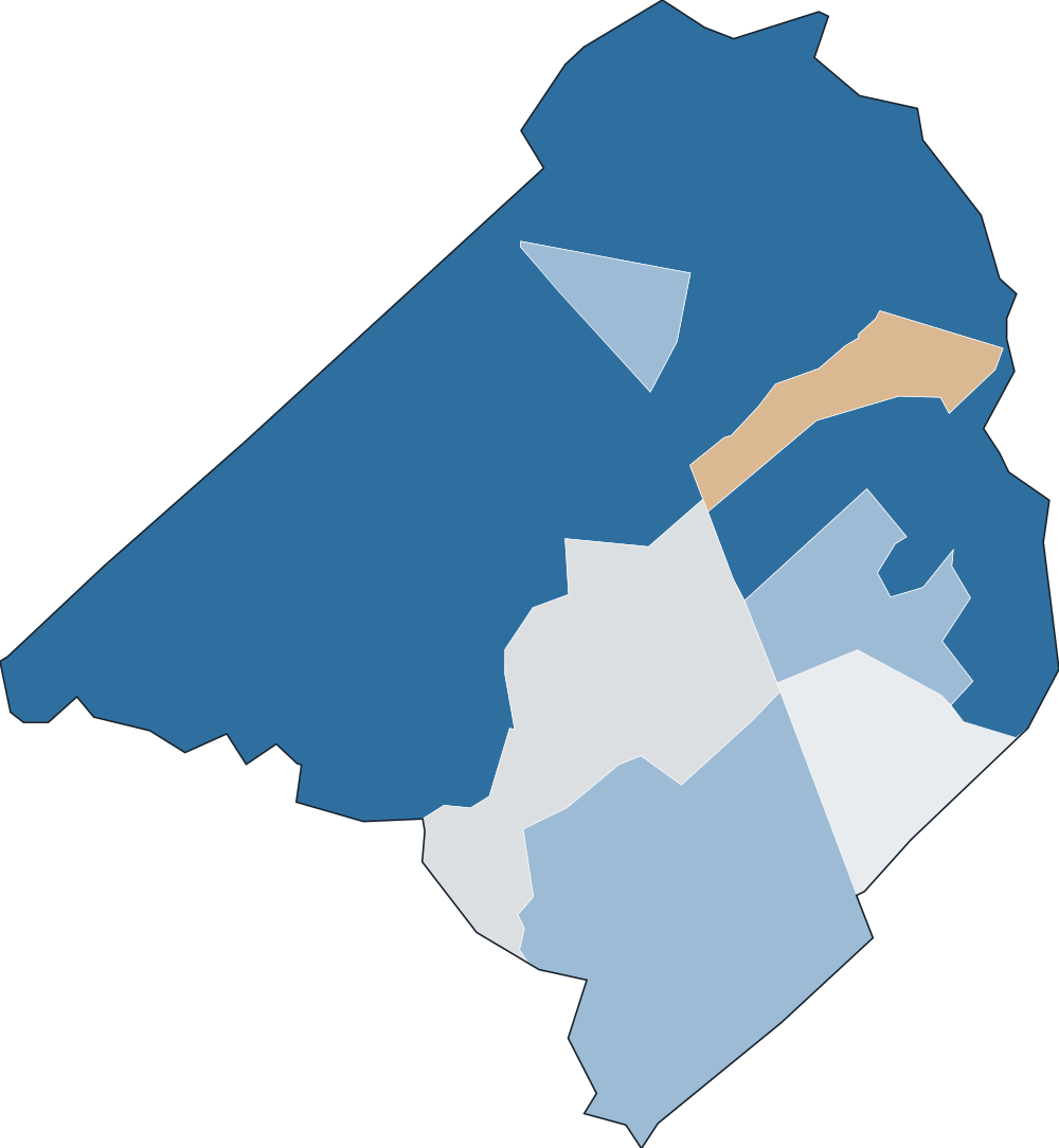
- 0–5071.0%
- 50–10019.3%
- 100–2007.4%
- 200–4002.0%
- 400+0.0%
Check an address in Marple
Every crime type in Marple is near or below the U.S. rate
Citywide indexWhere the middle half of residents live
Property crimes
Social disorder
Highest on weeknights
100 is the U.S. rate, same hours.
Expected major crime fell 7.4% in a year; across Pennsylvania it fell 8.6%
Change in the model's expected crimes, not a count of reports; Pennsylvania in gray. 2031 is a model projection, not tested against past years.
Marple against U.S. places with 10,000 to 25,000 residents
1,483 of the 2,480 other places of this size have a major-crime index at least 15% above Marple's, and 385 are within 15% of it; the middle of the group is 67. The 9 nearest in population:
U.S. = 100. Residents in gray.
Marple's major-crime index is higher than 3, lower than 4 and within 15% of 1 of its 8 nearest neighbors
The closest, Broomall (under 1 mi), is 37% above Marple's rate.
U.S. = 100. Miles between population centers.
Questions about crime in Marple
Is Marple safe?
Marple's major-crime index is 48, 52% below the U.S. rate per resident and lower than 51% of the 478 other Pennsylvania places on CrimeMetric: violent crimes against people are 87% below the U.S. rate, and property crimes 44% below the U.S. rate.
What is the crime rate in Marple?
The model expects about 203 major crimes a year in Marple, about 8.3 per 1,000 residents, 52% below the U.S. rate.
Is crime going up or down in Marple?
Expected major crimes in Marple are down 7.4% from a year earlier; across Pennsylvania they're down 8.6%.
What are the most common crimes in Marple?
By the model's expected count, the most common crimes against people and property are shoplifting (about 78 a year), other larceny (about 73 a year) and theft from vehicle (about 25 a year).
Are car break-ins common in Marple?
The model expects about 25 thefts from vehicles a year in Marple, 61% below the U.S. rate per resident.
Are car thefts common in Marple?
The model expects about 10 motor vehicle thefts a year in Marple, 75% below the U.S. rate per resident.
Is Marple safe at night?
The model's major-crime index is 53 on Sunday to Thursday nights from 6pm to 6am, against 49 at its highest in the daytime; 100 is the U.S. rate for the same hours. That's a citywide estimate per resident for those hours: it can't speak to a particular street, venue or evening. For one address, use the address lookup on this page.
Is crime in Marple higher than the Pennsylvania average?
Marple's major-crime index is 48, 42% below the Pennsylvania rate per resident. Pennsylvania as a whole is 84, where 100 is the U.S. rate.
How does crime in Marple compare with Broomall?
Broomall, under a mile away, has a major-crime index of 66, 37% above Marple's rate per resident. Marple's is 48.
How we calculated this
Each police agency's crimes, as reported to the FBI or estimated where it didn't report, are spread across the census block groups it serves using population, jobs, points of interest and, where available, local incident records. Marple's figures add up its 17 block groups. The index compares crimes per resident with the U.S. rate.
- Marple has no published incident records in our data, so its estimate relies on agency totals and neighborhood characteristics.
- Rates are per resident, so places where many people work or visit but few live, such as downtowns, airports and stadiums, can read high.
- Disorderly conduct and trespassing are modeled, because the FBI records them only through arrests.
- Residents: 24,473. Model updated Nov 10, 2026. Release 2026-11-10
Full method and validation·Data sources
CrimeMetric. "Crime in Marple, Pennsylvania." Vorp Labs, updated November 9, 2026 (model Nov 10, 2026). https://crimemetric.com/pa/marple
Quote this page's aggregate figures with a link to it. Data terms
Use these numbers in your product
Any U.S. address by API or MCP, free for 10,000 lookups a month.
Get a free API keyNearest cities we publish
Major-crime index, U.S. = 100
- Broomallunder 1 mi66
- Newtown Township3 mi20
- Haverford3 mi53
- Springfield Township3 mi31
- Drexel Hill4 mi94
- Media4 mi78
- Ardmore4 mi121
- Radnor4 mi26